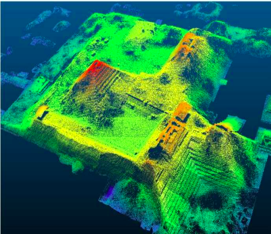
LiDAR Services Overview
NAVAL provides comprehensive LiDAR (Light Detection and Ranging) services utilizing advanced airborne and mobile laser scanning technology. Our LiDAR solutions deliver high-precision 3D data for diverse applications including infrastructure mapping, urban planning, environmental monitoring, and utility management.
With years of experience in point cloud processing and classification, we transform raw LiDAR data into actionable intelligence for our clients across government and commercial sectors.
Powerline Classification
The optimal combination of LiDAR data and fieldwork allows providing ultimate utility mapping services. By designing electrical networks in 2D and 3D from LiDAR and imagery, we provide accurate power line models at efficient costs. Our services include 2D & 3D power line network design, vegetation management, and PLS-CADD modeling.
UAV Point Classification
UAV point cloud datasets have been widely used in characterizing vegetation structure and terrain analysis. We extract UAV points manually as per client requirements with both horizontal and vertical accuracy using stereo images. Our team specializes in converting dense point cloud information into Digital Elevation Models (DEM), Digital Terrain Models (DTM), and Digital Surface Models (DSM).
Corridor Classification
Corridor mapping is essential for road development, railway development, and hydrological surveys. We utilize ALS (Airborne Laser Scanning), MLS (Mobile Laser Scanning), and UAV photogrammetry to capture high-density point clouds. Our transportation solutions enable clients to fast-track project completion without sacrificing accuracy or quality.
MLS Classification
Mobile Laser Scanning (MLS) point cloud classification is designed for labeling complex 3D urban scenes. We assign individual labels to different classes of objects, playing an essential role in 3D scene analysis workflows. Our expert team provides comprehensive MLS point classification services with years of GIS experience.
Our LiDAR Services Include:
- ✓ Airborne LiDAR data acquisition and processing
- ✓ Mobile Laser Scanning (MLS) for urban environments
- ✓ Point cloud classification and filtering
- ✓ Digital Terrain Model (DTM) generation
- ✓ Digital Surface Model (DSM) creation
- ✓ Powerline and utility network mapping
- ✓ Corridor and transportation mapping
- ✓ 3D urban modeling and visualization
- ✓ Vegetation analysis and management
- ✓ Infrastructure inspection and monitoring
- ✓ Flood risk assessment and hydrological analysis
- ✓ Environmental conservation mapping
Advanced LiDAR Capabilities
Digital Terrain Model (DTM)
The laser pulses emitted from airborne LiDAR systems may be reflected from man-made structures, vegetation, or the earthen surface. A single pulse may reflect from upper, middle, and lower tree canopy as well as the ground beneath, resulting in multiple measurable returns. We derive elevation of reflected surfaces based on pulse travel time and sensor position.
3D Modelling & Meshing
We offer a comprehensive suite of 3D modeling products designed for visualization, GIS applications, architectural modeling, and 3D graphic design. Our advanced meshing techniques convert point clouds into high-quality 3D models suitable for various applications including BIM, urban planning, and simulation.
Urban Planning Applications
Urban planning requires precise control of land use and design of urban environments. Our LiDAR data provides comprehensive information for transportation networks, infrastructure planning, and orderly development of settlements. We support research, analysis, strategic thinking, and public consultation processes.
Advance Classification & DSM
Digital Surface Models (DSM) capture both natural and built/artificial features of the environment including ground surface, vegetation, and man-made objects. DSM is useful for RF planning, landscape modeling, city modeling, and visualization applications.
Why Choose NAVAL for LiDAR Services?
- • Years of experience in LiDAR data processing and point cloud classification
- • Expert team of photogrammetric and GIS professionals
- • State-of-the-art equipment and software for data acquisition and processing
- • Comprehensive quality assurance and accuracy verification
- • Fast turnaround times without compromising quality
- • Expertise in diverse applications from infrastructure to environmental monitoring